FROM Y’ALL TO EH!!! Day 6 May 30, 2010 Silver City, MI to Copper Harbor, MI

We headed out this morning with Copper Harbor as our destination, which is at the very top of the Keweenaw Peninsula. It is the most northern place in Michigan and is part of what is commonly referred to as the Upper Peninsula. We also found out that there is a great rivalry between the Upper Peninsula and the lower section which is anything below the Mackinac Bridge. The residents of the Upper Peninsula call the other people Trolls, they who live below the bridge.

On our way to Copper Harbor we detoured off of Hwy 41 and took Hwy 203 which ran along the coast. We did this for both the scenery and to be able to stop at McLain State Park. We wanted to hike out to one of the many lighthouses that were in the area. So we had lunch down near the water and before we started the hike I had to dip my toes in the water. It was cold. We could still see ice out on the lake.


After my dip, as planned we were going to go hiking. It was a good plan until I couldn’t get Kathy off the swings. She bet some kid she could get higher than he could. She did pretty good, she came in second.

I finally dragged her off the swings and we headed out. It was a nice hike and we got a few pictures of the trail, the lighthouse and the beach.

Once we got back to the truck we headed out for Copper Harbor and Fort Wilkins Historic State Park where we planned to camp for the night. Once we got checked in we decided to bike over to a Lighthouse Viewing area to have a look at the Lighthouse which is now private property.


We left the lighthouse and headed to Fort Wilkins which is right next to the campground. It was built in 1844 to supposedly protect the copper prospectors from the Native American Indians. It is the last remaining original fort east of the Mississippi River. We had a look around, took a few pictures and headed back to campsite for supper. It was a good day.

FROM Y’ALL TO EH!!! Day 5 May 29, 2010 Silver City, MI

We decided to stay an extra day at Union Bay Campground so after breakfast we headed out to do some exploring. We planned to drive to the other end of the park and do some hiking into a group of waterfalls but first we stopped at Lake in the Clouds and walked into a cordoned off viewpoint. The viewpoint is at one of the highest elevations in the park and gave us a splendid view of the lake and the valley. The lake is over one mile in length but is only 16 feet at its deepest spot.


We left Lake in the Clouds and headed for the west end of the park and looked for a spot to have lunch. They actually had a parking and picnic at the trail head which made it very convenient. So we stopped and had some lunch before heading out.

The main attraction of this hike was the Falls but we found that they were small and unspectacular. However the walk was very nice, strenuous but nice as we walked through a forest that had some trees that were up to 4 centuries old.


The walk took us first to Manido Falls which actually looked like more like rapids but the water is very low for some reason.


As we carried on we came to Nawadaha Falls but found we couldn’t really get that close to it. We also discovered that the third falls was back the other way from where we started so we turned around and headed back. However not before we took a picture.


The hike out was just as strenuous going in as the up and down terrain had not changed in the short time since we had hiked in. We did make it back and headed over to the other falls which was called Manabezho Falls ( don’t ask me to pronounce any of them ). Again we were not overly excited but we were getting a good workout.


A short way from the third falls was a foot bridge over to an island which I don’t believe is named or I just missed it. Once you were on the island you could walk down to the shore of Lake Superior which we did before heading back. Lake Superior is the largest fresh water lake in the world.


Once we got back to the truck we headed back to our campsite and decided to go for another walk along the shore of Lake Superior.


It was a good way to end the afternoon so we headed back to the camper for supper and an early evening.


Another glorious day.

FROM Y’ALL TO EH!!! Day 4 May 28, 2010 Hayward, MN to Silver City, MI

We reluctantly left Lake Chippewa Campground at our usual get away time of 11AM, actually it was a little later but not that much. We headed back into Heyward to pick up Hwy 26 which we followed for a short way before we turned onto Hwy 2 which took us into Michigan.


The rest of the route had us following Hwy 2 until we came to Hwy 28 which we followed until we came to Hwy 64. At which time we turned due north on Hwy 64 and that took us into Silver City and the Porcupine Mountains. The day, due to the late start was spent mostly driving with a couple of stops for groceries and gas. The terrain was mostly forest and water and reminded me of the countryside where I grew up in Northern Ontario as it is all part of the Great Canadian Shield.

Our first look at Lake Superior
We arrived at Union Bay Parkground in the Porcupine Mountains National Park in the late afternoon, set up and called it a night.


It was an uneventful but very relaxing day.  It is nice to travelling again.

FROM Y’ALL TO EH!!! Day 3, May 27, 2010 Owatonna, MN to Hayward, MN

We said our goodbyes to Bert and Barbara and headed for St. Paul where we had to drop off a couple of prints. We were only about 40 miles from the gallery when we left in the morning as it was south of St. Paul in the bedroom community of Burnsville. This allowed dropping off the prints and skirting around the city and avoiding all the traffic. It was a good plan until we hit construction and then I remembered the 4 seasons in the north. Fall, Winter, Spring and Construction.

Undaunted we headed north still on Interstate 35 planning to cut off at highway 8 and enter into Wisconsin and travel into St. Croix before turning north and driving along the St. Croix National Riverway. However, Sheila, our Aussie navigator let us down ( Well, I couldn’t blame Kathy ) and we missed the turn. We ended up heading a further 32 miles north before we turned east and crossed the St. Croix River into Wisconsin.


We continued east for about 100 miles until we came to Hayward and decided to stop for the night. We found a lovely park about 15 miles out of town called Lake Chippewa Campground and settled in for the night. It is a beautiful spot right on the lake and we were able to get a spot on the water. It was a very quiet and peaceful night.


FROM Y'ALL TO EH!!! Day 2, May 27, 2010 Williamsburg, KS to Owatonna, MN

We got away this morning around 9AM from a nice little RV park in Williamsburg, KS. The route still kept us on Interstate 35 and the highway construction made for a little slower going. We are averaging about 460 miles a day.

It was not long after leaving Williamsburg that we came to the Iowa border and passed through Kansas City into Iowa.  In the process had to go through the city of Kansas City.

There is a lot of flat farm land in Iowa and everyone has heard of Iowa Corn but a lot of the land we passed through was laying fallow this year or it is too early for crops to be showing.


You also see quite a bit of cattle in Iowa but they don’t look right to me. I can’t put my finger on it but something is different about the cows in Iowa. However they do make good cheese.


It was in the great state of Iowa that Kathy revealed to me her true thoughts on retirement.


We crossed into Minnesota around 3 PM and continued onto the town of Owatonna where we stopped in at friends we had met while wintering in Hemet. Bert and Barb Antoine spend the summers here and were very gracious by not only inviting us to supper but let us hook up in their driveway for the night.


We had a delightful evening enjoying a great dinner, catching up, talking about new travels and ending it with a walk around Owatonna. They are very nice people and we thoroughly enjoyed our evening with them and thank them very much for their hospitality.


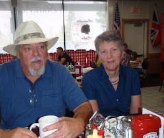
Looks like there was more talking than walking


Chinese Weeping Willow – This tree is in their front years and is over 6 feet at the base and is over 150 years old.

FROM Y'ALL TO EH!!! Day 1 May 25, 2010 Grapevine to Williamsburg, KS

Today is the first day in the new chapter in the continuing saga in the lives of Rod and Kathy.  We left Grapevine, Texas this morning just after nine ( really early for us ) and headed north on Intersate 35 with the final destination being Ontario, Canada.   The day started out pretty good as we travelled north through Texas but as we got about 100 miles into Oklahoma we hit major construction and lost about 2 hours of driving time. But hey, who cares.

Oklahoma is a producer of natural gas, oil, and agriculture. The majority of the state lies in the Great Plains and the U.S. Interior Highlands—a region especially prone to severe weather.  Along with Kansas they are probably the two states that see the most tornadoes every year.  Glad we a just passing through. 

We left Oklahoma early in the afternoon and crossed into Kansas.  The traffic was pretty light so we were able to make up some time.  We noticed that the terrain in Kansas is very similar to Oklahoma in many parts and of course they share the tornadoes with their Okie neighbour.  Kansas is one of the most productive agricultural states, producing many crops,  leading the nation in wheat, sorghum and sunflower production most years. You will also see a lot of cattle ranching in the state.  We arrived in Williamsburg around six and decided to stay here for the night so we found a RV park and hooked up. 

It was good to get back on the road again.